Fall Service · Within 100 Miles of Smiths Grove KY
Thermal drone deer recovery
Lost the blood trail after dark? A thermal-imaging drone sees what flashlights can't. FAA-certified pilot flying all night across South Central Kentucky — no hour is too late, and the search only gets harder once the sun is up.
How it works
Body heat doesn't hide.
A downed deer holds heat for hours, and against cool evening ground it glows on a thermal camera like a lantern in a field. When you've tracked as far as the sign takes you, stop — walking grids through the woods pushes a wounded deer farther and makes the job harder. Call or text instead. The drone flies a systematic search pattern over the area from above, covering in minutes what would take a search party all night, checking thickets, creek bottoms, standing crops, and the places you physically can't. When the deer is located, you're guided straight to it for recovery.
When to call
The best call is an early one — as soon as the trail goes cold, and ideally before the meat is at risk. Thermal works day or night, but it's at its best after dark and in cool conditions, which is exactly when Kentucky deer season delivers. Evening hit, lost trail at 9 PM? That's the perfect scenario for a thermal flight. Flights are conducted under an FAA Part 107 certificate with night-operations authorization — recovery only, after the shot, never to hunt, take, harass, or drive game. See the legal note below.
The equipment
This isn't a hobby drone with a heat filter. Recoveries fly on a DJI Matrice 4TD — the enterprise thermal platform the national drone-recovery community has standardized on — pairing a high-resolution radiometric thermal camera with a powerful optical zoom, so a heat signature spotted from altitude can be positively identified as your deer before anyone walks a step. It's the same class of aircraft flying search-and-rescue missions for public safety teams, doing the same job: finding what the ground can't.
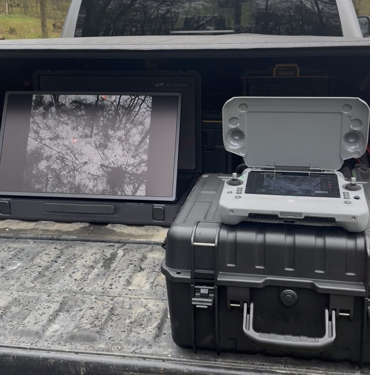
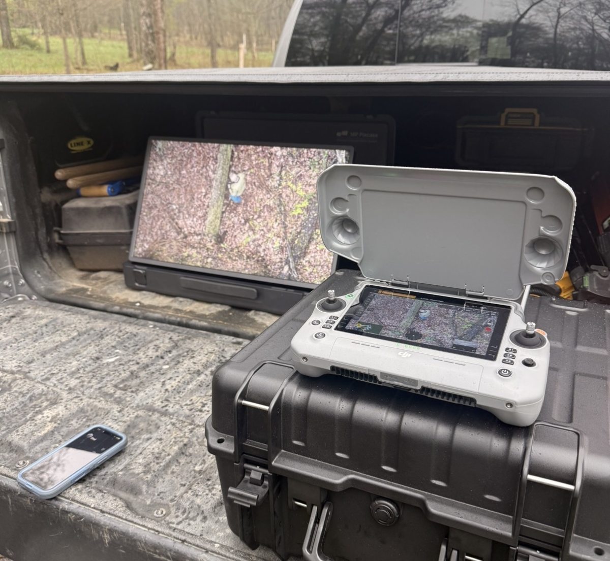
Off my own aircraft
This is what the camera actually sees.
Not stock footage. Both of these came off my Matrice on a September evening in South Central Kentucky, flying live deer for practice well before season. Nothing here is a recovery — it is the same camera, over the same kind of ground, doing the same job.
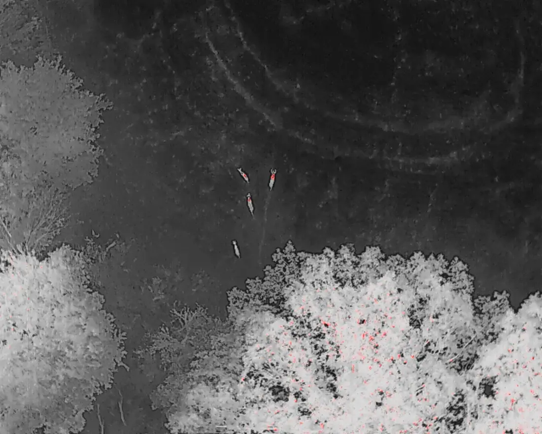
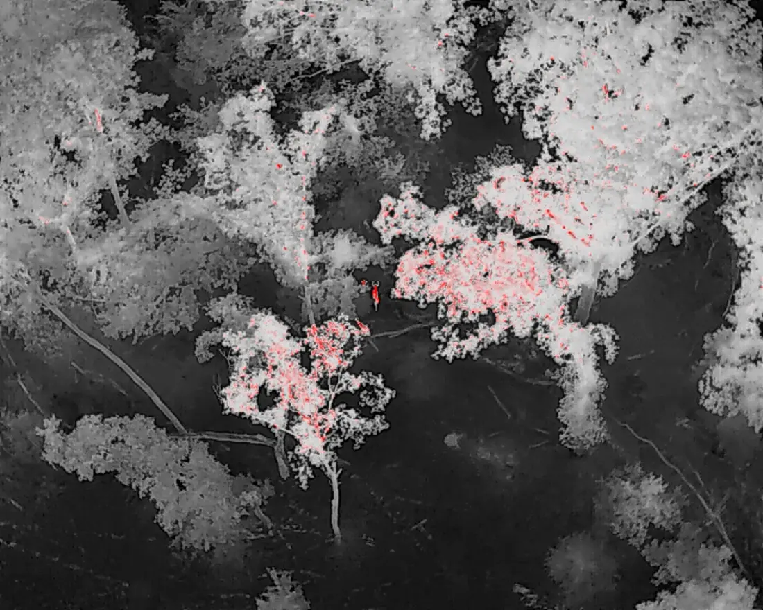
Both frames were taken minutes after sunset, and that timing is the point. The ground and the canopy are still dumping the day's heat right then, which is the hardest part of the night for a thermal camera. Every hour after that the ground cools, the contrast sharpens, and the picture gets better. Two in the morning is a better search than nine at night, not a worse one.
Thermal is not magic. It reads temperature difference, so anything that warms the ground or blocks the view works against it. When you call, an honest read on your odds is the first thing you will get.
Lost the trail? Do this right now
The next 30 minutes decide whether your deer gets found.
1. Mark last blood & back out
Drop a GPS pin or flag at the last confirmed blood, then leave the woods quietly. Do not grid-search — a wounded deer that gets bumped from its bed can run another half mile, and that can put it out of reach of any recovery method: drone, tracking dog, or grid line.
2. Call or text with the details
Call/text 270-681-0756 with the shot time, weapon (bow, crossbow, or rifle), where you believe the hit landed, and your GPS pin. That's everything needed to give you a straight answer on timing, odds, and price before anything flies.
3. Let conditions call the play
Sometimes the right answer is fly now; sometimes it's let the woods sit. Falling temperatures, incoming rain that will wash the trail, and coyote pressure all move that decision — and it's part of the phone call, honestly, even when the honest answer is "wait until dark." Thermal works best after sundown, when a deer's body heat glows against cool ground.
Whatever you call it — thermal drone deer recovery, drone deer tracking, infrared deer search, or just "help me find a lost deer" — the job is the same: locating a downed, legally harvested deer fast, before the meat or the trail is lost. Recovery only, after the shot, flown under FAA Part 107.
Coverage area
Based in cave country, serving the region
Home base near Smiths Grove — flying thermal deer recovery within roughly 100 miles in every direction, which covers most of western and south central Kentucky:
Owensboro, Beaver Dam, Hartford, Central City, Greenville, Morgantown — Daviess, Ohio, Muhlenberg, and Butler county hunters.
Bowling Green, Russellville, Franklin, Scottsville, Glasgow, Cave City, Horse Cave, Munfordville, Brownsville, Leitchfield — Warren, Logan, Simpson, Allen, Barren, Hart, Edmonson, and Grayson counties.
Tompkinsville, Edmonton, Columbia, Campbellsville, Monticello, Somerset, Danville — Monroe, Metcalfe, Adair, Taylor, Wayne, Pulaski, and Boyle county country.
Elizabethtown, Bardstown, Hodgenville, Leitchfield — Hardin, Nelson, LaRue, and Grayson county hunters.
Farther out? Call anyway — if the drone can get there in time to matter, we'll talk. The earlier you call after losing the trail, the better every one of these ranges works.
Deer recovery FAQ
Straight answers before you call
Should I call a thermal drone or a deer tracking dog?
Should I keep tracking while I wait for you?
Does it work in thick woods or standing corn?
How late can I call?
What does it cost?
Is this legal?
The hours I actually work
No hour is too late. Morning is the problem.
I fly these all night. Not "call in the morning and we'll sort something out" — if your deer went down at ten and the trail quit at one, one is when to call. Midnight, two, four, it does not matter. Deer recovery is a night job and I treat it like one.
Waiting for daylight is the one decision that reliably costs people their deer, and it is worth understanding why. Two things happen at once when the sun comes up. The carcass has been cooling all night and has less heat left to find. And the ground, the brush and the canopy start absorbing sun and warming up toward the same temperature the animal is at. The gap the camera depends on closes from both directions at the same time.
By mid-morning on a sunny day there is often nothing left to separate a deer from the field it is lying in. The same search that would have taken one pass at three in the morning can be impossible at ten. Coyotes work the overnight hours too, and they are not waiting for a convenient time either.
- Call when the trail dies, not when the sun comes up. Even if the plan is to wait several hours before anyone tracks, make the call early so the night is available to us.
- The overnight window is the good one. Ground cools, contrast sharpens, and the picture keeps improving until first light.
- If it is already daylight, call anyway. Cold, overcast days stay workable far longer than sunny ones. I will give you a straight read rather than take the job quietly.
270-681-0756. If you get voicemail I am probably already in the air on another one — leave the details and I will call the moment I am down.
What it costs
Get an estimate, and get me moving.
Takes about a minute No obligation Answering 24/7 in season
Flat call-out inside 40 minutes of Smiths Grove, $1 a round-trip mile past that, and a found fee only if we actually put you on the deer. Fill this out and you get a number on screen and the request hits my phone. Calling still gets me faster — 270-681-0756, day or night.
$375 call-out
Flat, inside roughly 40 minutes of Smiths Grove — Bowling Green, Glasgow, Cave City, Horse Cave, Munfordville, Brownsville, Morgantown, Scottsville, Franklin, Park City.
$1 per mile round trip
70 round-trip miles are included. Past that it is $1 per mile there and back, rising to $1.75 beyond 160 round-trip miles. It covers windshield time, not flight time — the search itself costs the same wherever it is.
$100 found fee
Charged only if the drone puts you on your deer. No find, no found fee — you still pay the call-out, because the aircraft flew and the search happened.
Hunting northeast Ohio? I'm back in that corner for stretches during the season and fly recoveries there under Ohio's written recovery rule. Details and coverage for Ashtabula, Trumbull and Mahoning counties →
Deer down and trail cold? Call now.
Fall response within about 100 miles of Smiths Grove. The earlier you call, the better the odds.
Call/Text 270-681-0756